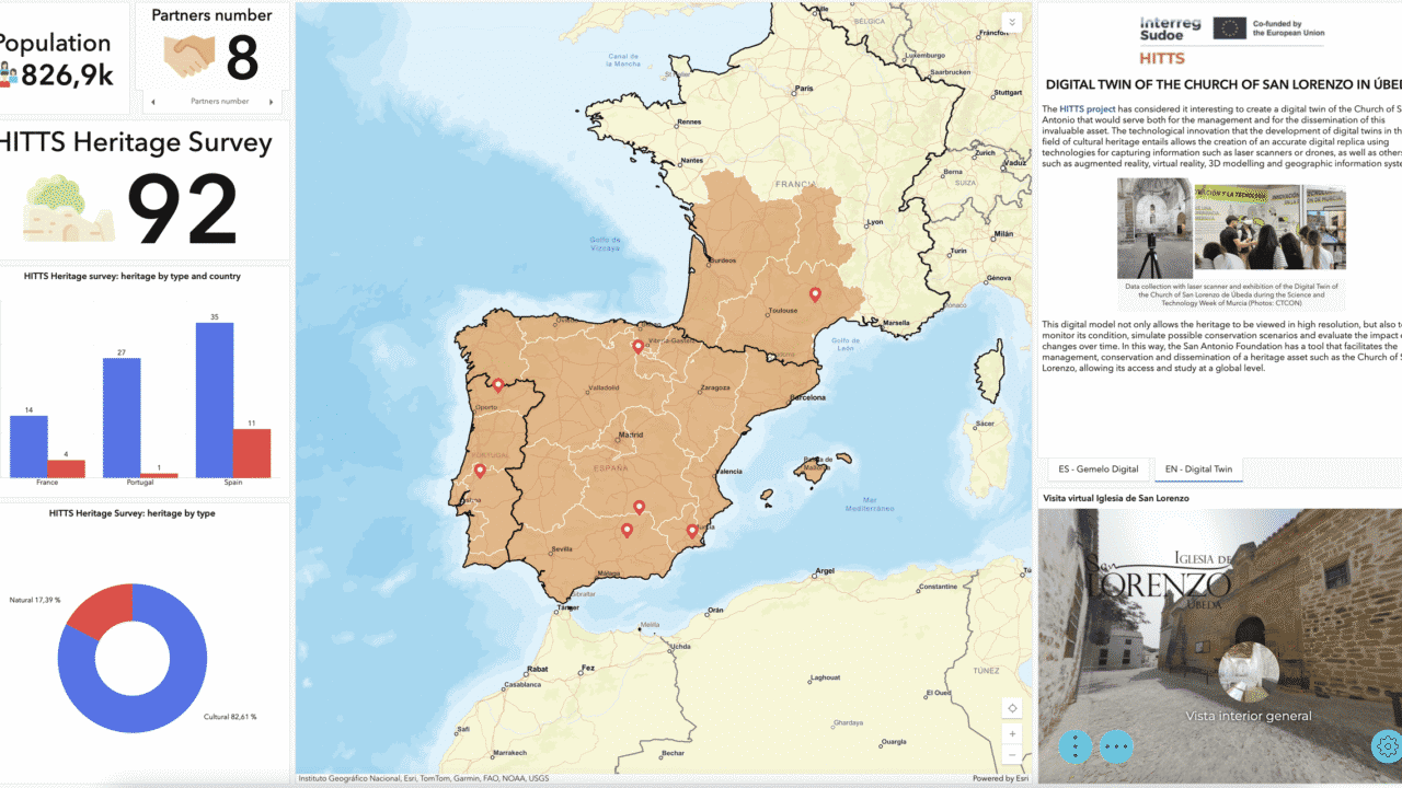
Innovation and technology have come together to revolutionize how we preserve and promote cultural heritage. During the first phase of the HITTS project, one of its partners, the Faculty of Tourism at the University of Murcia (The Open Faculty), implemented the use of Geographic Information Systems (GIS) to integrate territorial diagnostics from the project members. The result is an interactive map that has become an essential tool for exploring and understanding the cultural and natural heritage of the participating territories.
This map, available via this [link], allows for the precise localization of each cultural and natural heritage asset and includes informative files associated with each point. Additionally, it provides data about the project’s partners, the population of the involved areas, and the number of identified heritage elements.
A Digital Twin for the San Lorenzo Church in Úbeda
One of the project’s notable achievements is the creation of a digital twin of the San Lorenzo Church in Úbeda, the headquarters of Fundación Huerta de San Antonio. This site of immense cultural value has undergone extensive rehabilitation to transform it into a modern cultural center and a catalyst for neighborhood revitalization, forming the cornerstone of the foundation’s work. The digital twin facilitates the development of projects focused on virtual and augmented reality, using advanced technologies such as laser scanners and drones.
The digital twin not only provides a high-resolution visualization of the church but also enables monitoring its condition, simulating conservation scenarios, and analyzing the impact of potential changes over time. This tool represents a breakthrough in heritage management, offering Fundación San Antonio an advanced technological solution for the conservation and promotion of this significant monument.
A Promising Future for Cultural Heritage
The HITTS project demonstrates how technology can be a key ally in protecting and appreciating cultural heritage. With tools like the interactive map and digital twins, not only is the preservation of historical assets ensured, but their accessibility and study are also promoted on a global scale.
Explore the interactive map and discover how the HITTS project is transforming the way we connect with our heritage!
(https://theopenfaculty.maps.arcgis.com/apps/dashboards/c515f1a0f7dc44cfb83fb522f3c38d08)

