Prioridad:2 - Promoting social cohesion and territorial and demographic balance in Sudoe through innovation and the transformation of productive sectors
Objetivo específico:SO 1.1 (...) Research / Innovation
Idiomas: English , Español
Países: France , Portugal , Principality of Andorra , Spain
Regiones: Alentejo , Castilla y León , Cataluña , Centro , Comunidad de Madrid , Extremadura , Midi-Pyrénées (Occitanie) , Principado de Andorra
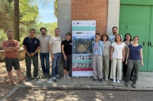
Descripción del proyecto
The Project will demonstrate the feasibility of low-cost wireless sensor networks (WSNs) for application in forest fire surveillance and early warning systems. To assess the risk and detect forest fires in the Sudoe, meteorological data and satellite images of the Earths surface (telection) are currently used with low spatial and temporal resolution and unreliable (high rate of false positives). In addition, weather and remote sensing equipment have a high cost. WSNs use electronic modules with sensors that measure the meteorological and environmental parameters involved in forest fire risk in real time. They are also endowed with computing and wireless communication, with each other and with the cloud. WSNs adapt to the characteristics of risk zones, are easy to deploy and scalable. They are a proximity tool that complements remote sensing and facilitates co-responsible risk management by municipalities, local communities and the inhabitants of risk areas. The Project will carry out Pilot Activities in areas of the Sudoe of different climate, orography and vegetation with objectives of prevention or early detection. It will also develop an Action Plan for the adoption of WSN in municipalities for meteorological and environmental monitoring purposes and an Action Plan for the training of professionals in WSN for environmental risk management. The WSN integrates multiple technologies with unequal levels of development in the Sudoe countries, so transnational cooperation is essential for the realisation of WSNs, Pilot Activities and Action Plans. These outputs will benefit municipalities (innovative technology for the effective management of environmental risks), land owners and users (protection of crops, pastures, forests and livestock), SMEs (high value added products and services and skilled professionals), young population (quality work and entrepreneurship) and the general population (health protection, property, infrastructure, natural and cultural heritage) of rural Sudoe.
Visitas:993
Beneficiarios
Principal Beneficiary Consejo Superior de Investigaciones Científicas, Instituto de Tecnologías Físicas y de la Información, Departamento de Sensores y Sistemas Ultrasónicos
Nombre del beneficiario: Consejo Superior de Investigaciones Científicas, Instituto de Tecnologías Físicas y de la Información, Departamento de Sensores y Sistemas Ultrasónicos
Región: España,Comunidad de Madrid,Madrid
Persona de contacto: Esther Hontañón Lavín
Email: esther.hontanon@csic.es
This beneficiary does not have a website
2 - Consejo Superior de Investigaciones Científicas, Instituto de Microelectrónica de Barcelona, Micro Nano systems deparment
Nombre del beneficiario: Consejo Superior de Investigaciones Científicas, Instituto de Microelectrónica de Barcelona, Micro Nano systems deparment
Región: España,Cataluña,Cerdanyola del Vallés
Persona de contacto: Stella Vallejos Vargas
Email: stella.vallejos@imb-cnm.csic.es
This beneficiary does not have a website
3 - ARANTEC Enginheria,S.L.
Nombre del beneficiario: ARANTEC Enginheria,S.L.
Región: España,Cataluña,VIELHA
Persona de contacto: Eisharc Lois Jaquet Solé
Email: ejaquet@arantec.com
This beneficiary does not have a website
4 - Ray Ingeniería Electrónica, S.L.
Nombre del beneficiario: Ray Ingeniería Electrónica, S.L.
Región: España,Extremadura,Mirabel
Persona de contacto: Raimundo Alfonso Sánchez
Email: ray@ray-ie.com
This beneficiary does not have a website
5 - Universidade de Évora, Escola de Ciências e Tecnologia
Nombre del beneficiario: Universidade de Évora, Escola de Ciências e Tecnologia
Región: Portugal,Alentejo,Évora
Persona de contacto: Pedro Salgueiro
Email: pds@uevora.pt
This beneficiary does not have a website
6 - Universidad de Extremadura , Escuela de Ingenierías Industriales , Departamento Ingeniería Eléctrica, Electrónica y Automática
Nombre del beneficiario: Universidad de Extremadura , Escuela de Ingenierías Industriales , Departamento Ingeniería Eléctrica, Electrónica y Automática
Región: España,Extremadura,Badajoz
Persona de contacto: Jesús Salvador Lozano Rogado
Email: jesuslozano@unex.es
This beneficiary does not have a website
7 - Município do Fundão
Nombre del beneficiario: Município do Fundão
Región: Portugal,Centro,Fundão
Persona de contacto: Michaela Gil
Email: michaelagil@cm-fundao.pt
This beneficiary does not have a website
8 - Centre National de la Recherche Scientifique, Délégation Occitanie Ouest, Centre Interuniversitaire de Recherche et d'Ingénierie des Matériaux
Nombre del beneficiario: Centre National de la Recherche Scientifique, Délégation Occitanie Ouest, Centre Interuniversitaire de Recherche et d'Ingénierie des Matériaux
Región: France,Midi-Pyrénées (Occitanie),Toulouse
Persona de contacto: Lionel Presmanes
Email: lionel.presmanes@univ-tlse3.fr
This beneficiary does not have a website
9 - Fundació Privada del Sector Públic Andorra Recerca i Innovació
Nombre del beneficiario: Fundació Privada del Sector Públic Andorra Recerca i Innovació
Región: Principado de Andorra,Principado de Andorra,Sant Julià de Lòria
Persona de contacto: Oriol Travesset Baró
Email: otravesset@ari.ad
This beneficiary does not have a website
10 - Consejo Superior de Investigaciones Científicas, Instituto Nacional de Investigación y Tecnología Agraria y Alimentaria (INIA), Instituto de Ciencias Forestales (ICIFOR) - Departamento de Dinámica y Gestión Forestal
Nombre del beneficiario: Consejo Superior de Investigaciones Científicas, Instituto Nacional de Investigación y Tecnología Agraria y Alimentaria (INIA), Instituto de Ciencias Forestales (ICIFOR) - Departamento de Dinámica y Gestión Forestal
Región: España,Comunidad de Madrid,Madrid
Persona de contacto: Mercedes Guijarro Guzmán
Email: guijarro@inia.csic.es
This beneficiary does not have a website
11 - Centre National de la Recherche Scientifique, Délégation Occitanie Ouest, Laboratoire d'Analyse et d'Architecture des Systèmes
Nombre del beneficiario: Centre National de la Recherche Scientifique, Délégation Occitanie Ouest, Laboratoire d'Analyse et d'Architecture des Systèmes
Región: France,Midi-Pyrénées (Occitanie),TOULOUSE
Persona de contacto: Philippe Menini
Email: menini@laas.fr
This beneficiary does not have a website
12 - Universidade de Coimbra, Faculdade de Ciências e Tecnologia, Departamento Engenharia Informática
Nombre del beneficiario: Universidade de Coimbra, Faculdade de Ciências e Tecnologia, Departamento Engenharia Informática
Región: Portugal,Centro,Coimbra
Persona de contacto: Catarina Silva
Email: catarina@dei.uc.pt
This beneficiary does not have a website
13 - Junta de Castilla y León, Consejería de Cultura, Turismo y Deporte, Dirección General de Patrimonio Cultural
Nombre del beneficiario: Junta de Castilla y León, Consejería de Cultura, Turismo y Deporte, Dirección General de Patrimonio Cultural
Región: España,Castilla y León,VALLADOLID
Persona de contacto: Enrique Gilarranz Leonor
Email: enrique.gilarranz@jcyl.es
This beneficiary does not have a website
Postgraduate course in “Wireless Sensor Networks for Environmental Risk Management”
Periodo: 2021-2027
Estado: On going
Prioridad: 2 - Promoting social cohesion and territorial and demographic balance in Sudoe through innovation and the transformation of productive sectors
Objetivo: SO 1.1 (...) Research / Innovation
This Action Plan aims to transmit the knowledge, technologies, developments and results of the Project to current and future professionals of the Sudoe. A transnational and interuniversity postgraduate course (hereinafter the Course) will be promoted to train professionals with a highly multidisciplinary profile in a variety of essential WSN technologies such as Sensor Science and Technology, Intelligent Devices and Systems, Wireless Technologies, Energy Microgeneration Technologies, Data Science and Technology, Cloud Technologies, Artificial Intelligence and others. The Course will show how to integrate these technologies into WSNs and how to adapt WSNs to local contexts so that their implementation, operation and maintenance is economically viable and sustainable over time. It will also show examples of applications from WSNs to environmental risk management in rural areas. The format of the Course will be that of ONLINE MASIVO and OPEN COURSE (MOOC), in which the consortium has previous experience; for example, the MOOC in “Low-cost sensors for air quality monitoring” of the NanoSen-AQM (Interreg V-B Sudoe) project. Two editions of the MOOC will be held in years 2 and 3 of the Project and the final version will be delivered in month 34. The University of Coimbra (FCTUC/DEI) will lead the Action Plan in which the beneficiary universities (B6, B8 and B9) and partners (A4) of the Project will participate. The R & D centres (B1, B2, B3, B11 and B12) will collaborate in the preparation of the Action Plan and provide training in the Course. CSIC and CNRS have a wide territorial implementation in ES and FR, share mixed centers and associated units with national universities and maintain collaborations with universities in other countries. This will make it possible to expand the number of participating universities and extend the scope of the Course to other regions of the Sudoe, as well as to other EU countries.
Application of WSN in municipal action plans and self-protection against forest fires
Periodo: 2021-2027
Estado: On going
Prioridad: 2 - Promoting social cohesion and territorial and demographic balance in Sudoe through innovation and the transformation of productive sectors
Objetivo: SO 1.1 (...) Research / Innovation
This Action Plan aims to promote the implementation of WSN in municipal action plans and self-protection against forest fires (PAMIF and PAIF) in the Sudoe. The municipalities of the pilot areas of Spain and Portugal will draw up plans to implement the WSNs in PAMIF and PAIF in the municipalities. This will be supported by own knowledge and experience in the application of technology in other areas (e.g. air quality), as well as on the knowledge and experience provided by the Project (GT3 and R3.1). The municipalities will establish the specific objectives of the plan, the municipal services that will be involved in its implementation, the chain of command and operations and the protocols of action. They will determine the material and human resources, infrastructures, equipment and training and training of the equipment necessary for the integration of WSNs. They will assess costs and identify sources of funding. The municipalities shall submit the plans to the competent higher authority, which shall decide on them. These are the Agência para a Gestão Integrada de Fogos Rurais (AGIF) of Portugal and the Directorate-General for Forest Policy of the Autonomous Communities in Spain. Public administrations and agencies will decide on the convenience/need to strengthen prevention and early detection in forest fire defence policies in the Sudoe. They will assess the advantages and benefits of the application of wireless sensor networks to forest fire management. JCYL DG Cultural Heritage will lead this realisation in which all the administrations and public agencies participating in the Project will participate.
Pilot activities in WSN for prevention and early detection of forest fires.
Periodo: 2021-2027
Estado: On going
Prioridad: 2 - Promoting social cohesion and territorial and demographic balance in Sudoe through innovation and the transformation of productive sectors
Objetivo: SO 1.1 (...) Research / Innovation
The campaigns described in GT3 represent pioneering Pilot Activities in the application of WSN to the prevention and early detection of forest fires, highlighting the extent of the territory and the diversity of locations, the variety of meteorological and environmental sensors, the size (number of nodes) of the WSNs, the duration of the campaigns and the participation of municipal forest fire fighting services and the local population. The Pilot Activities will bring together the knowledge and experience of forest fires accumulated by the consortium, bring new knowledge, technologies and results and allow to draw conclusions and learn lessons on the performance of WSNs. The consortium will translate the know-how acquired on the occasion of the Pilot Activities in two Practical GUIDES (GP) for the application of WSN to the prevention (GP_Prevention) and the early detection (GP_Detection) of forest fires. The GPs will serve as a reference and guidance on how to use WSNs to improve the anticipation and response capacity of rural municipalities and their inhabitants to forest fires. They will address aspects such as the identification and prioritisation of fire-vulnerable zones suitable for the establishment of WSN, WSN sizing and design, WSN deployment in the field, wireless infrastructure, energy efficiency and data transmission, cost assessment, sustainability and environmental impact, physical and information security, citizen participation and others. ICIFOR-INIA CSIC will lead the development of the GPs in which the entire consortium will be involved. A preliminary version of the GPs will be delivered in month 18 and the final version in month 34 of the Project.
SenForFire will participate in the webinar “Meteorological Hazard Alerts and Fire Behaviour Indicators”, organised within the framework of the FIREPOCTEP project.
The European SenForFire project is making progress in the development of sensors and prototypes for the prevention and early detection of forest fires.